
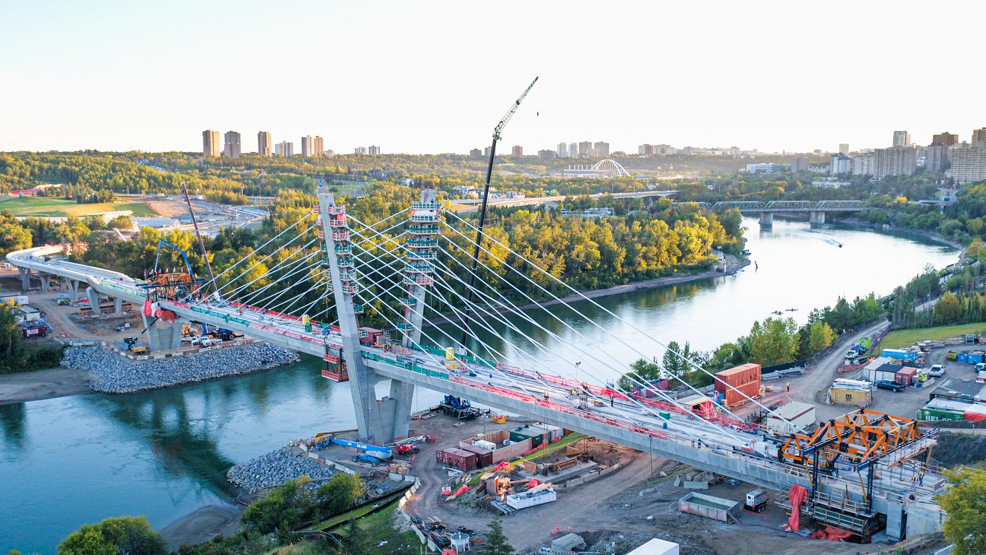
Aerial Imagery for Construction Projects in Edmonton
Look good from any angle.
Our professionally licensed drone pilots execute with thoughtful composition and cinematic motion to scaffold your organization to new heights.
Drone Photography services
we offer
-
Perfect for dramatic opening shots, construction timelapses from above, or showcasing the true scale of your project.
-
Above-ground photos that provide more context to your project and can give you an understanding of the lay of the land.
-
For the times your project is located near an airport, a helipad or near buildings and roads. Our advanced licensed pilots fly with precision and poise, no choppy or jerky shots.
-
Have a large-scale construction project that has big things moving? Let’s send a drone up and capture the magic as it happens.
-
If you have an ongoing construction project, we can do multiple site visits to capture milestone events for project documentation.
A whole new perspective
Drones capture images of your subject from virtually any angle. It’s an amazing way to treat your audiences to sky-high visuals while building context for your marketing assets.
Frequently Asked Questions
-
Yes, we take care of all permits for you. Most drone flights don’t require special permits (SFOCs) unless your site is near a hospital with a heli-pad, an active airport or if we’re filming an advertised event. Most of our projects take place on active jobsites with equipment moving, crews working, and tight safety protocols in place. We coordinate with your site supervisor, follow your safety orientation and PPE requirements, and plan our shooting schedule around your operations so our drone pilots don’t get in the way of the work.
-
Yes. Our drone pilots hold the appropriate Transport Canada certifications and follow all airspace regulations. We also maintain $5 million in insurance coverage required to operate on active construction and industrial sites. Before we fly, we review site constraints and any specific safety requirements with your team.
-
Yes. Aerial imagery is a core part of how we document large projects. We use drones to capture progress, show scale, and give stakeholders a top‑down view they can’t get from the ground. Drone coverage can be set up as one‑off flights for key milestones or as a recurring schedule over the life of a project.
-
Yes. Many of our projects are driven by stakeholder relations, not just marketing. Using aerial imagery, we create videos and imagery that help display the scale of the project and give context to your complex work to residents, partners, regulators, and internal leadership. Our drone footage can be used for progress updates, “what’s happening here” explainers, or recap videos at key milestones.
-
We do. We can plan a coverage schedule that follows your project from early works through to completion. That might include monthly progress visits, milestone shoots, seasonal updates, and a final wrap‑up piece. Consistent documentation gives you a valuable record for reporting, future bids, and your own project archive.
-
We can. Many of our clients have sites spread across Alberta or Western Canada and prefer to work with one visual partner they trust. Travel logistics and costs are built into the quote upfront so there are no surprises. If you’re outside our usual radius, we’ll let you know what’s realistic.

Let’s go.
Book aerial imagery for your project.